Capture reality with precision using iTwin Capture, transforming real-world conditions into high-quality digital twins for analysis, visualization, and infrastructure project planning.
iTwin Capture enables organizations to transform real-world conditions into accurate digital representations using advanced reality capture technologies. By integrating data from drones, mobile mapping systems, and laser scanning, it allows teams to generate high-fidelity 3D models that support better planning, monitoring, and decision-making across infrastructure projects.
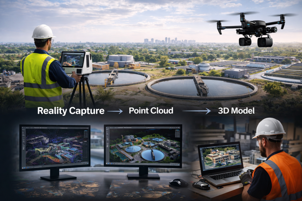
iTwin Capture is a powerful reality modelling solution designed to convert real-world data into precise and scalable digital twins. By processing images, point clouds, and geospatial data, it enables users to create detailed 3D models of infrastructure assets and environments.
The platform supports data captured from a variety of sources, including drones, LiDAR scanners, and mobile mapping systems, allowing for comprehensive and accurate site representation. These models can be used throughout the project lifecycle, from initial planning and design to construction monitoring and asset management.
With its ability to deliver high-resolution, georeferenced outputs, iTwin Capture improves collaboration between teams, enhances situational awareness, and supports data-driven decision-making. It plays a critical role in enabling digital workflows across engineering, construction, and infrastructure management.
iTwin Capture is widely used across infrastructure and engineering projects, including:
• Reality modelling and digital twin creation • Aerial and drone-based site mapping • Infrastructure inspection and monitoring • Construction progress tracking and verification • Asset documentation and lifecycle management • Terrain modelling and geospatial analysis • Urban planning and environmental assessment
iTwin Capture enables engineering teams, surveyors, and infrastructure owners to capture, visualize, and manage real-world conditions with greater accuracy, improving project outcomes and operational efficiency.
Watch a introductory video for iTwin Capture
View the product video on YouTube to learn more about its capabilities, workflows, and use cases.
LumenRT is Bentley Systems’ premier real-time visualization engine used to create immersive, cinematic experiences for infrastructure projects. At Hertford Systems, ...