Descartes is Bentley Systems’ advanced 2D and 3D imaging software used to process, manipulate, and integrate reality modeling data into engineering workflows. At Hertford Systems, we leverage Descartes to help teams bridge the gap between raw reality capture and actionable high-fidelity engineering models.
Descartes is Bentley Systems’ premier reality data processing application that enables engineers to integrate point clouds, scalable terrain models, and raster imagery into their design environment. It provides a comprehensive set of tools for editing and cleaning reality data, allowing users to move from raw sensor captures—such as 3D laser scans or drone-based photogrammetry—to refined digital twins. By combining reality modeling with traditional CAD workflows, Descartes ensures that design projects are built upon a foundation of accurate, real-world context. The platform supports modern digital engineering, helping firms improve the precision of their infrastructure assets while significantly reducing the time required for data preparation.
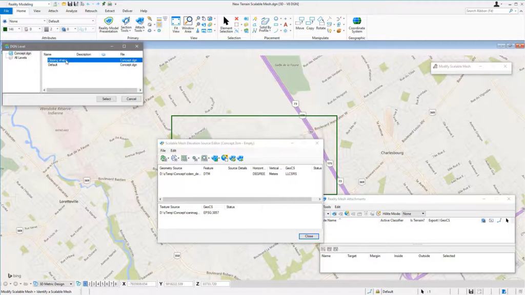
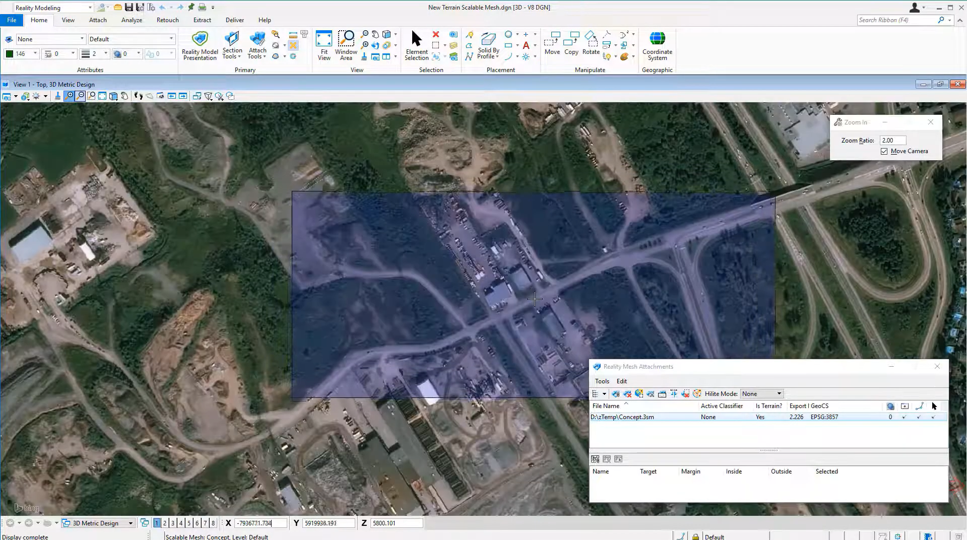
Descartes provides a complete solution for processing and managing massive reality datasets, allowing engineers to manipulate large-scale imagery and 3D point clouds with ease. Built on Bentley’s high-performance graphics technology, Descartes combines raster-to-vector conversion with advanced 3D modeling tools to support every phase of the reality modeling lifecycle.
The software enables users to clean up point cloud “noise,” extract terrain features, and drape high-resolution imagery over complex 3D meshes. By connecting reality data with design and construction workflows, Descartes improves visibility for project stakeholders and supports better decision-making through enhanced spatial awareness. Using Descartes, teams can work more efficiently while ensuring that their digital twins are a perfect reflection of real-world site conditions.
Descartes supports a wide range of reality modeling projects across the transportation, utility, and urban development sectors.
Key applications include:
Processing and manipulation of large-scale 3D point cloud data
Integration of reality meshes with 2D and 3D engineering designs
Advanced raster editing and clean-up of legacy paper drawings
Generation of scalable terrain models from reality capture data
Extraction of 3D features and vector geometry from imagery
Hybrid modeling combining reality data with parametric design elements
Texture mapping and orthophoto production for site visualization
Digital twin workflows for accurate “as-built” asset documentation
These capabilities allow engineers and surveyors to transform raw data into high-value engineering models that are better aligned with actual site constraints.
Watch a introductory video for Descartes
View the product video on YouTube to learn more about its capabilities, workflows, and use cases.
LumenRT is Bentley Systems’ premier real-time visualization engine used to create immersive, cinematic experiences for infrastructure projects. At Hertford Systems, ...
Capture reality with precision using iTwin Capture, transforming real-world conditions into high-quality digital twins for analysis, visualization, and infrastructure project ...